mNo edit summary Tags: Visual edit apiedit |
No edit summary Tag: sourceedit |
||
| Line 16: | Line 16: | ||
|- |
|- |
||
|[[Plateau]]||[[Central Plains]]||Hills ESE just outside of [[Oilville]]||/waypoint 4310000 3457500 |
|[[Plateau]]||[[Central Plains]]||Hills ESE just outside of [[Oilville]]||/waypoint 4310000 3457500 |
||
| + | |- |
||
| + | |[[Plateau]]||[[Central Plains]]||9 nodes around hills NW side of [[Oilville]]||/waypoint 4285000 3485000 |
||
|- |
|- |
||
| || || ||/waypoint |
| || || ||/waypoint |
||
Revision as of 13:47, 26 February 2015
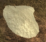
A geologic chemical deposit node
| Region | County | Area | Coordinates |
|---|---|---|---|
| Plateau | Central Plains | SE of the Zanesville Airstrip | /waypoint 4522500 3500000 |
| Plateau | Central Plains | Hills ESE just outside of Oilville | /waypoint 4310000 3457500 |
| Plateau | Central Plains | 9 nodes around hills NW side of Oilville | /waypoint 4285000 3485000 |
| /waypoint |
| Region | County | Area | Coordinates |
|---|---|---|---|
| Northfields | East of Credit Bend | Hilltop | /waypoint 4763942 5447889 |
| Region | County | Area | Coordinates |
|---|---|---|---|
| /waypoint |
| Region | County | Area | Coordinates |
|---|---|---|---|
| /waypoint |
| Region | County | Area | Coordinates |
|---|---|---|---|
| /waypoint |
| Region | County | Area | Coordinates |
|---|---|---|---|
| /waypoint |