No edit summary |
No edit summary Tag: Visual edit |
||
| (18 intermediate revisions by 7 users not shown) | |||
| Line 7: | Line 7: | ||
|harvest1 = Weak Geologic Chemical |
|harvest1 = Weak Geologic Chemical |
||
}} |
}} |
||
| − | {|border="2" cellpadding="4" cellspacing="0" class="wikitable sortable" |
+ | {| border="2" cellpadding="4" cellspacing="0" class="wikitable sortable" |
| − | !nowrap="true"|Region |
+ | ! nowrap="true" |Region |
| − | !nowrap="true"|County |
+ | ! nowrap="true" |County |
| − | !nowrap="true"|Area |
+ | ! nowrap="true" |Area |
| − | !nowrap="true"|Coordinates |
+ | ! nowrap="true" |Coordinates |
|- |
|- |
||
| − | |[[Plateau]]||[[ |
+ | |[[Plateau]]||[[Central Plains]]||SE of the [[Zanesville]] Airstrip||/waypoint 4522500 3500000 |
|- |
|- |
||
| − | |[[Plateau]]||[[ |
+ | |[[Plateau]]||[[Central Plains]]||10 nodes around hills ESE just outside of [[Oilville]]||/waypoint 4310000 3457500 |
|- |
|- |
||
| − | |[[Plateau]]||[[ |
+ | |[[Plateau]]||[[Central Plains]]||9 nodes around hills NW side of [[Oilville]]||/waypoint 4285000 3485000 |
|- |
|- |
||
| − | |[[Plateau]]||[[Embry Commonwealth]]|| |
+ | |[[Plateau]]||[[Embry Commonwealth]]||Around the hill between [[South Burb]] and [[North Burb]]||/waypoint 4426870 3225961 |
|- |
|- |
||
| − | |[[Plateau]]||[[Embry Commonwealth]]|| |
+ | |[[Plateau]]||[[Embry Commonwealth]]||Inside the mine of the Survivalist Camp NE of [[South Burb]]/SE of [[North Burb]]||/waypoint 4489685 3245951 |
| ⚫ | |||
| − | |[[Plateau]]||[[Embry Commonwealth]]||North of [[Embry Crossroads]]||/waypoint 4258500 3242500 |
||
|} |
|} |
||
| Line 35: | Line 33: | ||
|harvest2 = Impure Geologic Chemical |
|harvest2 = Impure Geologic Chemical |
||
}} |
}} |
||
| − | {|border="2" cellpadding="4" cellspacing="0" class="wikitable sortable" |
+ | {| border="2" cellpadding="4" cellspacing="0" class="wikitable sortable" |
| − | !nowrap="true"|Region |
+ | ! nowrap="true" |Region |
| − | !nowrap="true"|County |
+ | ! nowrap="true" |County |
| − | !nowrap="true"|Area |
+ | ! nowrap="true" |Area |
| − | !nowrap="true"|Coordinates |
+ | ! nowrap="true" |Coordinates |
| ⚫ | |||
| + | |[[Northfields]]||East of [[Credit Bend]]||Hilltop||/waypoint 4763942 5447889 |
||
|} |
|} |
||
| + | |||
{{Node |
{{Node |
||
|name = Geologic Chemical Deposit |
|name = Geologic Chemical Deposit |
||
| Line 49: | Line 50: | ||
|harvest1 = Impure Geologic Chemical |
|harvest1 = Impure Geologic Chemical |
||
}} |
}} |
||
| − | {|border="2" cellpadding="4" cellspacing="0" class="wikitable sortable" |
+ | {| border="2" cellpadding="4" cellspacing="0" class="wikitable sortable" |
| − | !nowrap="true"|Region |
+ | ! nowrap="true" |Region |
| − | !nowrap="true"|County |
+ | ! nowrap="true" |County |
| − | !nowrap="true"|Area |
+ | ! nowrap="true" |Area |
| − | !nowrap="true"|Coordinates |
+ | ! nowrap="true" |Coordinates |
| + | |- |
||
| + | | || || ||/waypoint |
||
|} |
|} |
||
| + | |||
{{Node |
{{Node |
||
|name = Geologic Chemical Deposit |
|name = Geologic Chemical Deposit |
||
| Line 64: | Line 68: | ||
|harvest2 = Average Geologic Chemical |
|harvest2 = Average Geologic Chemical |
||
}} |
}} |
||
| − | {|border="2" cellpadding="4" cellspacing="0" class="wikitable sortable" |
+ | {| border="2" cellpadding="4" cellspacing="0" class="wikitable sortable" |
| − | !nowrap="true"|Region |
+ | ! nowrap="true" |Region |
| − | !nowrap="true"|County |
+ | ! nowrap="true" |County |
| − | !nowrap="true"|Area |
+ | ! nowrap="true" |Area |
| − | !nowrap="true"|Coordinates |
+ | ! nowrap="true" |Coordinates |
| + | |- |
||
| + | | || || ||/waypoint |
||
|} |
|} |
||
| + | |||
| + | [[File:Geologic_chemical_deposit.png|thumb]] |
||
| + | {{Node |
||
| + | |name = Geologic Chemical Deposit |
||
| + | |minenode = 1 |
||
| + | |knowledge = Mine Chemicals |
||
| + | |skillreq = 120 |
||
| + | |harvest1 = Impure Geologic Chemical |
||
| + | |amount1 = 1-6 |
||
| + | |harvest2 = Weak Geologic Chemical |
||
| + | |amount2 = 1-6 |
||
| + | }} |
||
| + | |||
| + | {{Node |
||
| + | |name = Geologic Chemical Deposit |
||
| + | |minenode = 1 |
||
| + | |knowledge = Mine Chemicals |
||
| + | |skillreq = 150 |
||
| + | |harvest1 = Average Geologic Chemical |
||
| + | |amount1 = 1-6 |
||
| + | |harvest2 = Impure Geologic Chemical |
||
| + | |amount2 = 1-6 |
||
| + | |harvest3 = Weak Geologic Chemical |
||
| + | |amount3 = 1-6 |
||
| + | }} |
||
| + | {| class="wikitable sortable" cellspacing="0" cellpadding="4" border="2" |
||
| + | ! scope="col" |Region |
||
| + | ! scope="col" |County |
||
| + | ! scope="col" |Area |
||
| + | ! scope="col" |Coordinates |
||
| + | |- |
||
| + | |[[Kaibab Forest]]||[[:Category:Stronghold|Stronghold]]||This nodes spawn only when [[Stronghold Pumpjack Bundle 3|Stronghold Pumpjacks]] have been placed||/waypoint 6568506 4980766 |
||
| + | |} |
||
| + | |||
{{Node |
{{Node |
||
|name = Geologic Chemical Deposit |
|name = Geologic Chemical Deposit |
||
| Line 78: | Line 118: | ||
|harvest1 = Average Geologic Chemical |
|harvest1 = Average Geologic Chemical |
||
}} |
}} |
||
| − | {| |
+ | {| class="wikitable sortable" cellspacing="0" cellpadding="4" border="2" |
| − | !nowrap="true"|Region |
+ | ! nowrap="true" |Region |
| − | !nowrap="true"|County |
+ | ! nowrap="true" |County |
| − | !nowrap="true"|Area |
+ | ! nowrap="true" |Area |
| − | !nowrap="true"|Coordinates |
+ | ! nowrap="true" |Coordinates |
| + | |- |
||
| + | |[[Kaibab Forest]]||[[Terminal Woods]]||5 nodes near the top of the [[Ranger Station]]||/waypoint 6553824 4357503 |
||
|} |
|} |
||
| + | |||
{{Node |
{{Node |
||
|name = Geologic Chemical Deposit |
|name = Geologic Chemical Deposit |
||
| Line 93: | Line 136: | ||
|harvest2 = Pure Geologic Chemical |
|harvest2 = Pure Geologic Chemical |
||
}} |
}} |
||
| − | {| |
+ | {| class="wikitable sortable" cellspacing="0" cellpadding="4" border="2" |
| − | !nowrap="true"|Region |
+ | ! nowrap="true" |Region |
| − | !nowrap="true"|County |
+ | ! nowrap="true" |County |
| − | !nowrap="true"|Area |
+ | ! nowrap="true" |Area |
| − | !nowrap="true"|Coordinates |
+ | ! nowrap="true" |Coordinates |
| + | |- |
||
| + | |[[Kaibab Forest]]||[[Terminal Woods]]||3 nodes around a farmhouse far in the southwest||/waypoint 6280097 4227849 |
||
| + | |- |
||
| + | |[[Kaibab Forest]]||[[Terminal Woods]]||3 nodes far in the southwest||/waypoint 6265760 4229688 |
||
| + | |- |
||
| + | |[[Kaibab Forest]]||[[Terminal Woods]]||6 nodes in [[Bergman's Burrow]]||/waypoint 6645938 4556578 |
||
| + | |- |
||
| + | |[[Kaibab Forest]]||[[Terminal Woods]]||8 nodes east of [[Eatman's Motel]]||/waypoint 6376606 4528388 |
||
| + | |- |
||
| + | |[[Alpha County]]||[[Alpha Zone]]||3 nodes in the southern part of [[Blockade]]||/waypoint 6404525 3775563 |
||
|} |
|} |
||
Revision as of 17:56, 21 May 2018
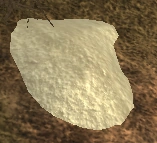
A geologic chemical deposit node
| Region | County | Area | Coordinates |
|---|---|---|---|
| Plateau | Central Plains | SE of the Zanesville Airstrip | /waypoint 4522500 3500000 |
| Plateau | Central Plains | 10 nodes around hills ESE just outside of Oilville | /waypoint 4310000 3457500 |
| Plateau | Central Plains | 9 nodes around hills NW side of Oilville | /waypoint 4285000 3485000 |
| Plateau | Embry Commonwealth | Around the hill between South Burb and North Burb | /waypoint 4426870 3225961 |
| Plateau | Embry Commonwealth | Inside the mine of the Survivalist Camp NE of South Burb/SE of North Burb | /waypoint 4489685 3245951 |
| Region | County | Area | Coordinates |
|---|---|---|---|
| Northfields | East of Credit Bend | Hilltop | /waypoint 4763942 5447889 |
| Region | County | Area | Coordinates |
|---|---|---|---|
| /waypoint |
| Region | County | Area | Coordinates |
|---|---|---|---|
| /waypoint |
| Region | County | Area | Coordinates |
|---|---|---|---|
| Kaibab Forest | Stronghold | This nodes spawn only when Stronghold Pumpjacks have been placed | /waypoint 6568506 4980766 |
| Region | County | Area | Coordinates |
|---|---|---|---|
| Kaibab Forest | Terminal Woods | 5 nodes near the top of the Ranger Station | /waypoint 6553824 4357503 |
| Region | County | Area | Coordinates |
|---|---|---|---|
| Kaibab Forest | Terminal Woods | 3 nodes around a farmhouse far in the southwest | /waypoint 6280097 4227849 |
| Kaibab Forest | Terminal Woods | 3 nodes far in the southwest | /waypoint 6265760 4229688 |
| Kaibab Forest | Terminal Woods | 6 nodes in Bergman's Burrow | /waypoint 6645938 4556578 |
| Kaibab Forest | Terminal Woods | 8 nodes east of Eatman's Motel | /waypoint 6376606 4528388 |
| Alpha County | Alpha Zone | 3 nodes in the southern part of Blockade | /waypoint 6404525 3775563 |